Futaleufu River
Know Futaleufu River
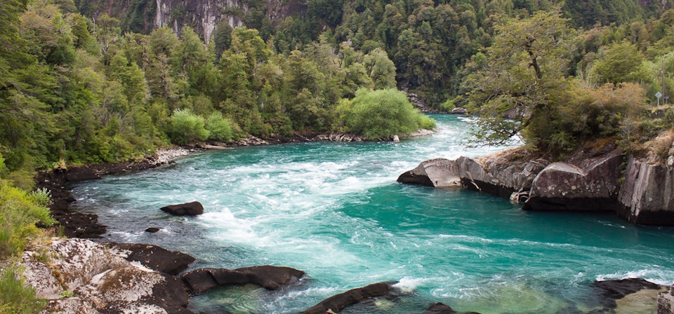
Declared Turism Attaction Zone by the National Tourism Service, Futaleufu River is also known as the “Wild River” (with a flow that goes from 347, 499 to 735 m3/s). Its characteristics turn it into the perfect place for extreme sports lovers. It has 3 sectors with 110 meters of width. Futaleufu River flows in Yelcho lake and it has an extraordinary landscape, that allows you to practice river rafting and see several valleys.
Información del Destino:
- Attractions:
Different speed caudal river, that allows you the river kayak and rafting practicing, among others.
- When to go:
All year.
- Activities:
Horseback riding, trekking, kayak, rafting, canoe, rowing, flora and fauna contemplation, photography.
- Weather:
Rainy, moderate. Rains all year.
- Location:
Different speed caudal river, that allows you the river kayak and rafting practicing, among others.
- Services;
Housing, food, transportation, outdoor activities, camping
- How to get there:
Santiago-Puerto Montt: Land route and airway.
Puerto Montt-Chaiten: Airway, by Chaiten small airport
Land route : Austral Route R7 -78 kilometers-. Also, you can get here by Paso Futaleufu -10 kilometers- (route that conects Chile with Argentina) - Surroundings:
Yelcho Lake, Espolon Lake, Pumalin Park, Hornopiren National Park, Pumalin Park, Futaleufu National Reserve, Palena National Reserve, Encuentro River, Puelo River, El Amarillo Springs, Llancahue Springs.
Nearby tourist attractions
-
Chaiten - 77 kmLago Yelcho - 41 kmParque Pumalín - 66 kmReserva Nacional Futaleufu - 4 km
-
Reserva Nacional Palena - 76 kmRuta Austral - 85 kmRuta Austral Puelo - Futaleufu - 72 km