Conguillio National Park
Know Conguillio National Park
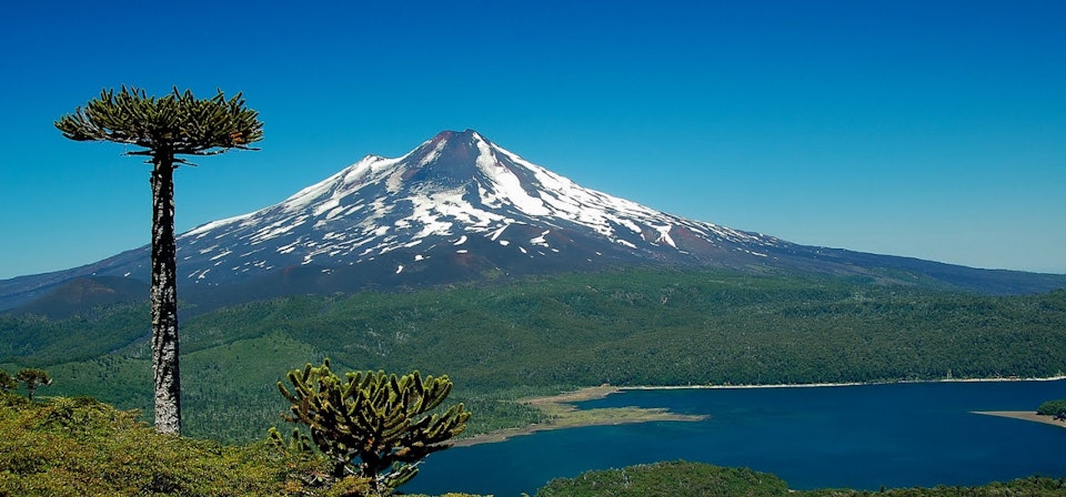
This national park has 60832000 square meters and hold Curacautin, Lonquimay, Melipeuco and Vilcun towns. Declared National park in 1950, is administrated by the CONAF and offers an information center, camping, housing, picnic zones, first aids and food centers to visitors.´ From Conguillio you can see the Llaima volcano (3125 meters above the sea level), the Conguillio lake, the Verde, Caren and Arcoiris Lagoons and Las Araucarias, Sierra Nevada and Las Vertientes paths. Also, you can find a marvelous flora and fauna.
Información del Destino:
- Attractions:
Flora and fauna. Different services, administrate them by the CONAF.
- When to go:
All year long.
- Activities:
Trekking, horseback ridings, bicycle ridings, high mountain tours, ski, sport fishing, picnic, swimming, flora and fauna contemplation, photography.
- Weather:
Rainy moderate weather. This weather has rains during all year long; in the interior, the temperature oscillates between day and night time. In the high lands there´s a cold weather.
- Location:
Flora and fauna. Different services, administrate them by the CONAF.
- Services;
Information center, forest ranger.
- How to get there:
From Temuco: Land route, to Melipeuco.
From Victoria: Land route.
- Surroundings:
Los Arenales Winter Center, Volcán Lonquimay Winter Center, Mesacura Hill, Colico Lake, Conguillío Lake, Arcoiris Lagoon, Galletue Lagoon, Malalcahuello, Conguillío National Park, Tolhuaca National Park, Alto Bío Bío National Reserve, Dillo River, Indio Waterfalls, Manzanar Springs, Llaima Volcano, Tolhuaca Volcano.
Nearby tourist attractions
-
Araucanía Andina - 21 kmCentro Invernal Volcán Lonquimay - 31 kmLago Caburgua - 52 kmLago Villarrica - 76 kmLaguna Icalma - 34 kmOjos del Caburgua - 66 kmParque Nacional Huerquehue - 52 kmParque Nacional Tolhuaca - 62 km
-
Parque Nacional Villarrica - 88 kmPucón - 73 kmReserva Nacional Ralco - 85 kmTemuco - 82 kmTermas de San Luis - 76 kmTermas del palguin - 92 kmVillarica y Pucón - 80 kmVillarrica - 85 kmVolcán Villarrica - 88 km