Tourism in Plaza de Armas

Know Plaza de Armas
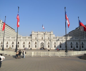
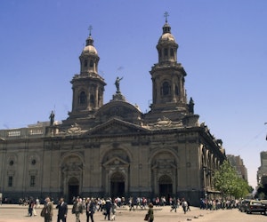
Santiago´s Main Square was the principal civic center when Santiago was found by the Spaniards in the 16th century. In Colony times, the square was used for popular activities like fairs and civil ceremonies. as well as commercial activities. During the Bernardo O´Higgins government, the commercial activity migrated to the Central Market. In the 19th century, authorities ordered to construct gardens and a place for music in the square. In 1999, the main square was rebuilt thanks to the construction of a new subway line. Gardens were reconstructed and it now has a more modern look.
Información del Destino:
- Attractions:
Cultural and historical interest zone.
- When to go:
All year long.
- Activities:
Photography.
- Weather:
Mediterraneo weather. There is a dry season and rains during winter time. The annual media temperature is 14ºC, and the annual media precipitation is 356.2 milimeters.
- Location:
Cultural and historical interest zone.
- Services;
Housing, food, transportation, outdoor activities.
- How to get there:
To Santiago: Airway, to the Arturo Merino Benitez International Airport. Also, land route, by Route Panamericana 5.
From Valparaiso: Land route, by Cuesta La Dornida (Route 68)
You can access to the main square from Ahumada, Merced, Monjitas and Catedral streets, and Plaza de Armas Metro Station (subway) - Surroundings:
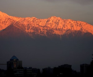
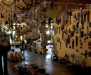
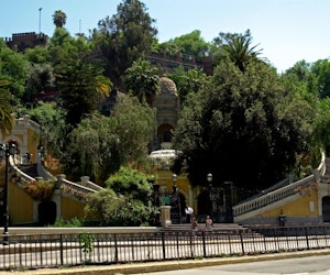
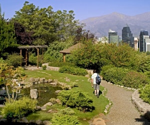
Barrio Italia-Condell, Barrio Balmaceda, Barrio Bellavista, Barrio Brasil, Barrio Suecia, Barrio Concha and Toro, Barrio Lastarria, Barrio Paris-Londres, Barrio Patronato, Barrio Republica, Barrio Yungay, Caleu, Canteros de Colina, El Colorado Ski Center, La Parva Ski Center, Valle Nevado Ski Center, Santa Lucia Hill, El Arrayan, Maipú Battle Historical field, Calan Hill Observatory, Metropolitan Park, Forestal Park, Caren Lagoon and Park, Los Dominicos Town, Mapocho River, Viña Cousiño Macul.
Nearby tourist attractions
-
Balneario Algarrobo - 94 kmBalneario de Reñaca - 97 kmBalneario Rocas de Santo Domingo - 92 kmBarrio Cívico de Santiago - 1 kmCajón del Maipo - 35 kmCaleta de Pescadores Portales - 98 kmCasa de Neruda - 95 kmCentro de Esqui Chapa Verde - 71 kmCentro de Esquí EL Colorado - 36 kmCentro de Esqui La Parva - 36 kmCentro de Esqui Lagunillas - 54 kmCentro de Esqui Portillo - 82 kmCentro de Esqui Valle Nevado - 39 kmCerro Santa Lucia - 0 kmCon-Con - 98 kmEl Ingenio - 50 kmEmbalse el Yeso - 59 kmFarellones - 32 kmIsla Negra y San Antonio - 90 kmLa Sebastiana (Casa Pablo Neruda) - 100 kmLaguna de Aculeo - 51 kmLaguna El Peral - 89 kmLaguna Sausalito - 95 kmLos Andes y Portillo - 72 kmPalacio Cousiño - 1 kmPalacio de La Moneda - 0 kmParque Forestal - 0 kmParque Laguna Caren - 18 kmParque Nacional La Campana - 68 km
-
Playa Amarilla - 98 kmPlaya Larga Santo Domingo - 94 kmPomaire y Valle del Maipo - 42 kmRancagua y Valle de Cachapoal - 80 kmReserva Forestal Lago Peñuelas - 86 kmReserva Nacional Río Clarillo - 39 kmRuta del Vino de Cachapoal - 94 kmSantiago - 6 kmSantiago y Farellones - 16 kmTermas de Cauquenes - 90 kmTermas de Jahuel - 77 kmTermas El Corazón - 71 kmValparaíso - 98 kmValparaíso y Viña del Mar - 96 kmViña Concha y Toro - 22 kmViña Cousiño Macul - 9 kmViña del Mar - 96 kmViña El Sauce - 82 kmViña Portal del Alto - 33 kmViña Santa Rita - 31 kmViña Tarapacá Ex Zavala - 45 kmViña Undurraga - 31 km
Tours
-
![]()
![]()
![]() Tour in Santiago, Isla Negra and Maipo Canyon
Tour in Santiago, Isla Negra and Maipo CanyonNear the capital Santiago, there are several places to enjoy the mountain and the beach. Experience the adventure with this 4-night program…
5 Days / 4 NightsFrom USD $454 -
![]()
![]()
![]() 4Santiago, Coast and Central Valley WineriesMulti-destino
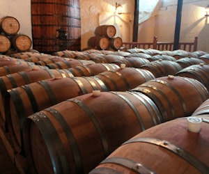
4Santiago, Coast and Central Valley WineriesMulti-destinoThe surroundings of Santiago have charm and diversity of landscapes that a traveler can not miss when visiting the capital of Chile. Visit Isla…
4 Days / 3 NightsFrom USD $308 -
![]()
![]()
![]() 4.5Santiago City Tour
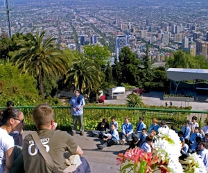
4.5Santiago City TourDiscover a capital combining his Colonial legacy with the modernity of a striving city. Meet its old streets with skycrappers on the background…
4 HoursFrom USD $30 -
![]()
![]()
![]() 4.5Santiago, Maipo Canyon and Valparaíso
4.5Santiago, Maipo Canyon and ValparaísoGet to know the Central Coast, the Andes Mountains, Laguna del Yeso and the coast of Historic Valparaiso, with this 3-night program.
4 Days / 3 NightsFrom USD $337 -
![]()
![]()
![]() 5Travel Santiago, Mountains and Vineyards
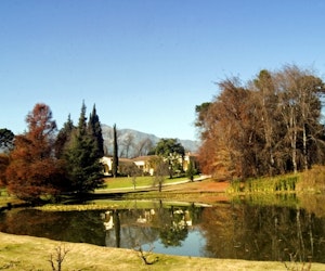
5Travel Santiago, Mountains and VineyardsSantiago is the capital city of Chile and the 5th largest in Southamerica. Discover Santiago through this program of 3 nights.
4 Days / 3 NightsFrom USD $378


Why book with us?
- Best price without complications
- Best Quality Guaranteed
- Passenger service available 24/7
- Tours and Experiences selected by experts
- Industry leader
- 18 years of experience